Scientific Fishery Systems, Inc

|
|
Scientific Fishery Systems, Inc
|
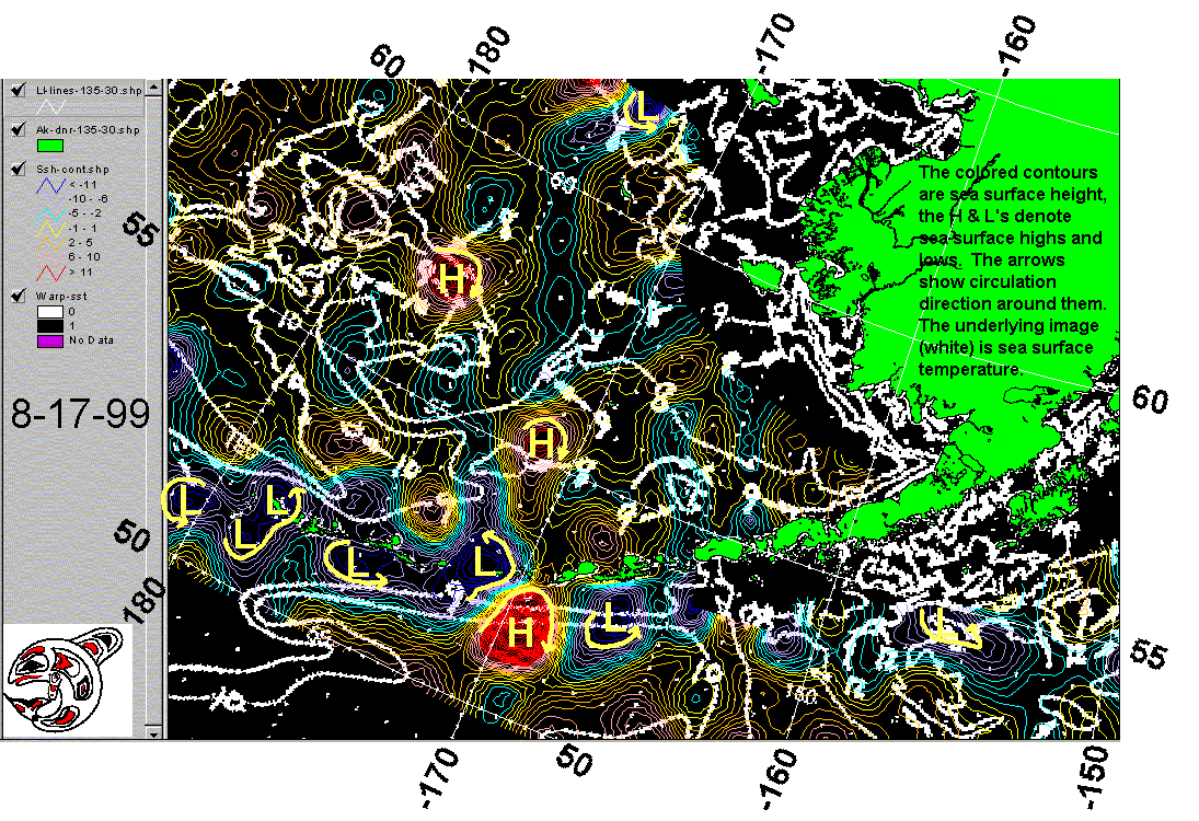
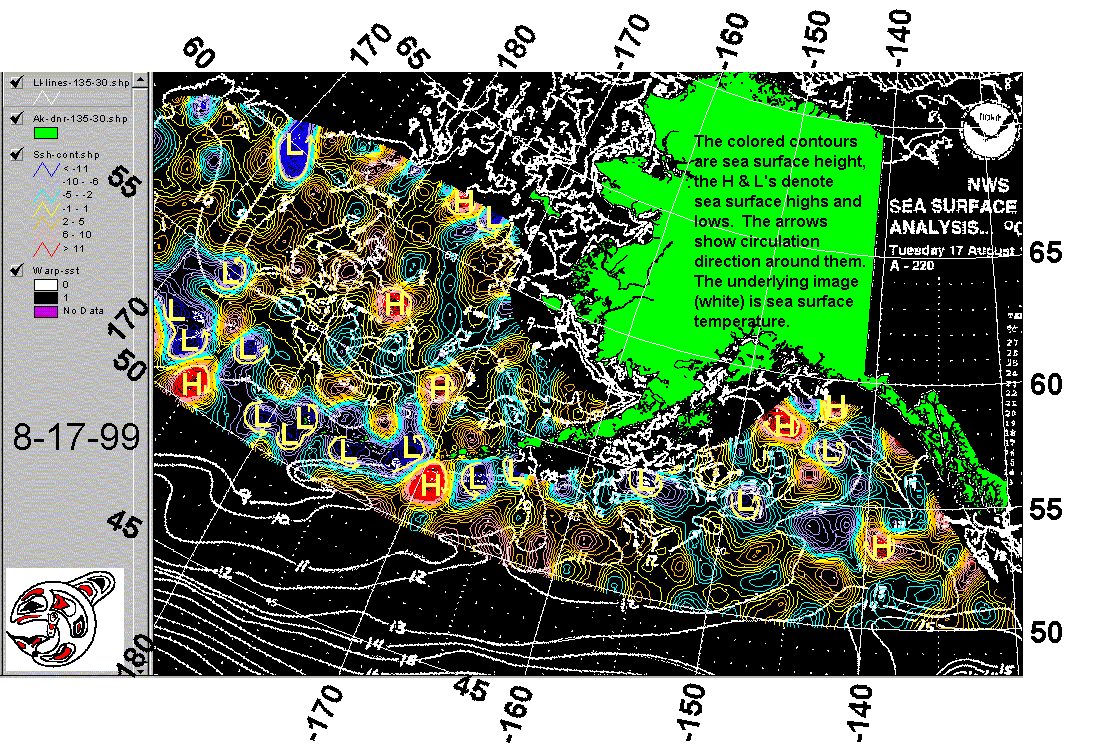
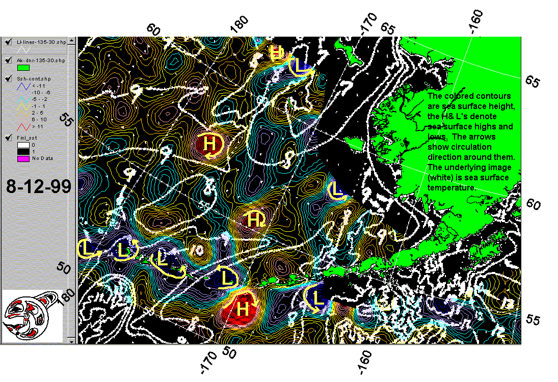
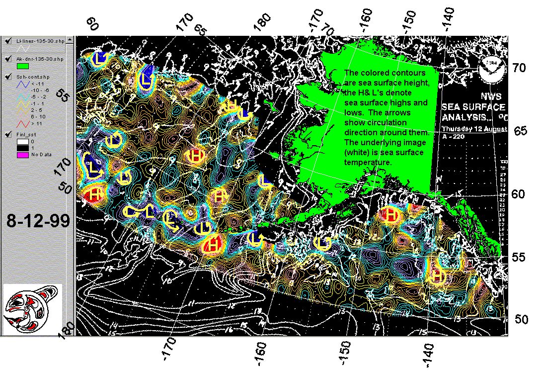
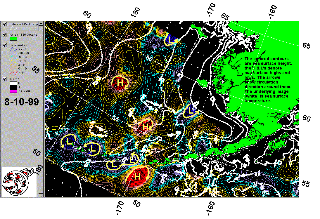
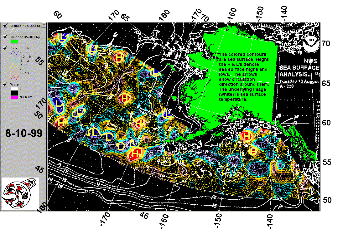
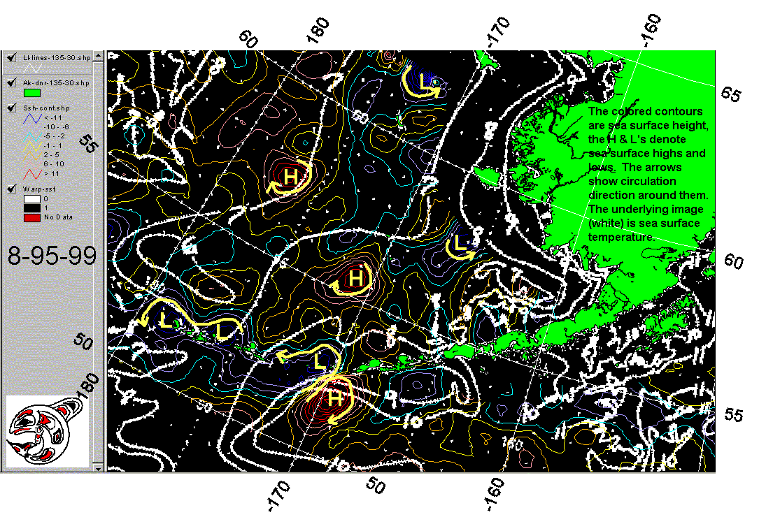
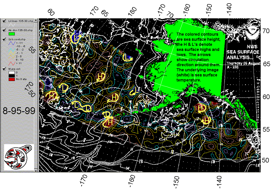
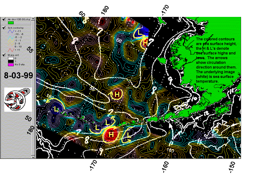
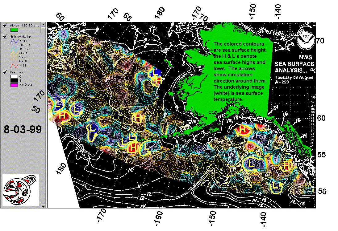
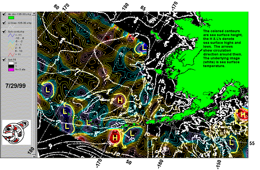
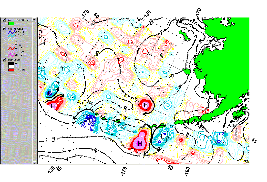
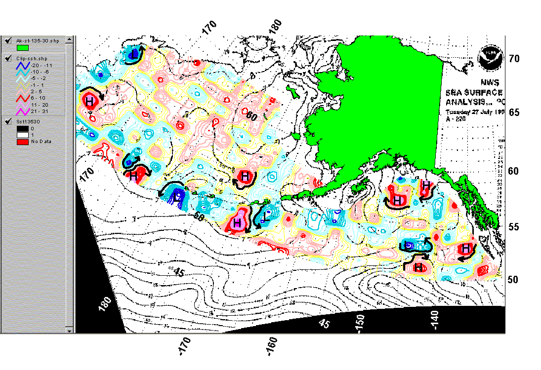
Fish aggregate along strong gradients in temperature and
current. Using data provided by the National Weather Surface and
NASA, SciFish has produced a composite map showing the sea surface temperatures
and heights of the North Pacific Ocean and Bering Sea. Fishers can
locate those areas that are most likely to contain fish by looking for
the eddies and currents located near strong sea surface highs and lows.
Select the image for your date of interest in the table below..
|
|
|
|
|
|
|
|
|
|
|
|
|
|
|
|
|
|
|
|
|
|
|
|
|
|
|
|
|
|
|
|