Fortymile
River Raft Adventure
Detailed Itinerary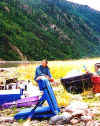
Day 1 The
trip begins at 8AM, meeting at the Snowshoe Inn, (downtown at 826 K Street). From here
we'll head north toward Cantwell and lunch somewhere in the Alaska Range. In the early
afternoon we'll continue on by road and cross the Denali "Highway", a 140 mile
gravel road across wide valleys, alpine tundra and breathtaking scenery that is open only
in the summer months and the only road through this remote area. Crossing glacial river
and lake country, wildlife viewing opportunities abound in this large stretch of
wilderness inhabited year-round only by the occasional trapper and wilderness hermit.
We'll stop along the way at a couple of the unique seasonal establishments to mingle with
some of the locals at the historic Maclaren River Lodge, in the heart of the Tangle Lakes
Archeological District, traditional hunting grounds since the time of those that crossed
the Bering Land Bridge to people the Americas. After reaching Paxson, we will turn north
on the Richardson Highway and travel a few miles to reach our camp at the base of the
imposing Gulkana Glacier. For those inclined, there is an excellent hike up to the
glacier, across a swinging bridge, and onto the face for great views of Summit Lake and
the mountains in the distance.
Day 2
From Gulkana we will get an early start to continue north through the Alaska Range
following the Delta River to Delta Junction, and then take the Alaska Highway to Tok.
Here, we'll pick up the twisting gravel road to historic Eagle, home of the early Army
outpost of Fort Egbert, the army's northernmost presence until World War II. Eagle has
long served as the last supply post for the vast upper Yukon valley, providing the
earliest miners and current wilderness dwellers with their link to mail delivery,
telephones and the rest of the world. Its frontier nature hasn't changed much, as it is
still cut off from the rest of the road system during the eight winter months of the year.
We'll dine and bunk for the night in historic cabins overlooking the Yukon. Listed in the
National Register of Historic Places, here is where the famous Norwegian explorer Roald
Amundsen "wintered", after arriving in December of 1905 from mushing by dog team
from his ship locked in the ice 1000 miles to the north. It was by telegraph from Eagle
that he was able to notify the world of his success in finding the long sought Northwest
Passage, after three years with no communication.
Day 3
After breakfast we'll tour about Eagle and historical Ft. Egbert, while the guides make
the final equipment preparations. Beginning in late morning the ferry flights by bush
plane will begin, across the mountains to an old gravel airstrip at the abandoned mining
community of Joseph. Toting our gear about a hundred yards puts us on the bank of the
Middle Fork of the Fortymile, and here we'll blow up the rafts and assemble the oar
frames, stow the gear and hit the water. Downstream we go, with camp depending on what
time we get on the river.
Day 4 - 9
As the water level varies considerably in the Fortymile depending on recent
precipitation and the winter's snowfall, travel times each day also vary greatly from one
trip to the next, and so only highlights are presented here to accommodate the changing
conditions.
The Fortymile is a clear stream, nationally
designated both Wild and Scenic, that drains a huge area of the Upper Yukon valley country
known simply as, the Fortymile country. It flows at a fairly steep gradient towards the
Yukon, alternating between stretches of Class II and III rapids with rock gardens to pools
of flatter water, with some of the runnable rapids approaching Class IV at high water.
Long home to the Athabaskan and Han native cultures, it was during historic times scene of
one of Alaska's earliest gold rushes, and still supports some placer gold mining activity.
The drainage also forms the principal range for the Fortymile caribou herd, that only a
few decades ago, numbered almost half a million animals. It has currently dropped to about
60,000 due to hunting, predation and natural cycles, though it is in the process of
rebounding. The country is also home to a great variety of wildlife associated with
Alaska, including grizzly and black bear, moose, eagles, wolverines, wolves and the
endangered peregrine falcon. Though due to the harshness of the winter climate the area
does not support a great density of wildlife, the river is a central corridor and we have
gone from seeing eagles, bear and moose along the banks to listening to a wolf pack
serenade us during dinner --all in one day.
The country is entirely
mountainous, with the river cutting deeply into the old 4000-6000 foot mountains and
alpine tree line reaching almost to the river in places. This allows for some great
impromptu hikes scrambling up ridgelines for great views, as there are few trails in this
country. If the river is fast at the time of travel and we are making good time, then the
opportunities for hiking will be more numerous. The river is quite intimate and lovely in
that it flows through narrow valleys and directly against rock cliffs and scree slopes in
many places. Camping is plentiful in this seldom traveled country, and sites will depend
on water levels and daylight, with most being on gravel bars or even islands in the river.
We will be putting in on the Middle Fork of the Fortymile, with the North Fork joining
between Bald Eagle Rapids and another set known as, The Chute. As with any river, the
personality and challenge of each rapid changes directly with the water level, with some
being more intense at higher water while others prove more challenging at lower water
levels. On roughly Day 5 we will encounter The Kink, a Class V rapid that we will most
likely portage, though at some water and experience levels can be run. The Kink is a
fascinating feature that will require explanation on location. As to whether we run it or
not, we'll see when we get there . . .
Shortly after The Kink, the South Fork enters and adds considerably to the flow, creating
sets of standing waves in places to keep things lively. After crossing under the bridge of
the road to Eagle, we'll come upon the old mining community of Steele Creek, childhood
home to Anne Purdy who wrote the locally famous book, Tisha, a work of historical fiction
about her days growing up in the wild north. Next is Deadman's Riffle rapid followed by
the US-Canada border (no customs!). A short ways into Canada we pass through the sets of
rapids known as The Canyon, before the river settles down and slows towards its arrival at
the Yukon. We'll more than likely camp across the river at the confluence, but will visit
the abandoned settlement of Fortymile, a fascinating ghost town last occupied in 1938.
Still standing are a number of gold rush log buildings in good shape including a church,
store, warehouse, and local headquarters of the Royal Canadian Mounted Police, that beg to
be explored . . .
Day 9
The wide valley of the Yukon with its vistas will be a great contrast to the Fortymile,
though its fast current is for the most part unimpeded by obstructions or the resulting
whitewater. We'll more than likely camp on an island for fantastic sunset views, with a
morning departure floating us back across the U.S. border and into Eagle. Solidly back on
"terra firma", we might stretch our legs with a short but vigorous hike to the
top of Eagle Bluff, long a landmark to river travelers. After a sumptuous dinner, we'll
again spend the night in the cabins by the river, that by now have come to feel like home.
Day 10
Early in the morning we continue following the road back to Tok and on though Mentasta
Pass along the Copper River. We'll camp on a great bluff overlooking the broad plain of
the Copper River and portions of our nation's largest national park, the Wrangell-St.
Elias. Great views of the snow capped volcanoes of Mt. Sanford and Drum towering over the
valley make it a very special spot.
Day 11
We'll get a reasonable start in order to play a bit on our return, stopping for lunch at
Glennallen. From here the beautiful Glenn Highway splits the Talkeetna and Chugach
mountains, following the Matanuska River past the glacier of the same name. We'll arrive
back in Anchorage in the early evening, somehow just a bit different than when we left,
and most likely figuring out just when you can return . . .
Return to Fortymile Adventure Introduction
Return to Main Page